

The Lainbach although looking relatively harmless at many days
it is really not! An only one big thunderstorm at the
Benediktenwand about more than one decade ago was sufficient to cause a
disaster. Even the oldest inhabitants had not been able to remember
such an event, nor had they heard similar stories from their
ancestors. The huge amount of water flowing from all directions
made the Lainbach a wild ripping stream. It destroyed the affixed
bankway, the concrete walls of the riverbanks and bridges with
brutal force. Big amounts of disrooted trees had been carried away
and shuffled themselves to vast heaps. The Lainbach-valley within a
few hours had been an impenetrable wilderness.
Nowadays we are again able to walk through the valley and to pursue
the great necessary endeavours of the river-maintenance-office
Weilheim by order of the freestate Bavaria to tame the nature in
the valley. Deserving thanks a torrent-teaching-course was
established in order to brief the people about the necessity of
many expensive measures highly necessary to diminish consequences
of possible future disasters.
At first our way nr. 456 to the Tutzinger hut follows the Lainbach
almost one hour.
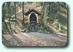
Coming from the Alpenwarmbad-swimming-pool, after having crossed
the new bridge over the brook, we stand in front of a typical
bavarian pray- and memorial place. In a sort of little house there
is a statue of Holy Mary and in front of it luminous candles. To
the right leads a sacral cross-roads. Left and right we can see a
so called station of it.
Here we are at the right place. Directly in lengthening the
bridgeway the way nr. 455 leads upward to the Tutzinger hut.
But we want to follow the more interesting torrent-teaching-course
along the Lainbach and turn to the left always walking along the
bank of the brook.
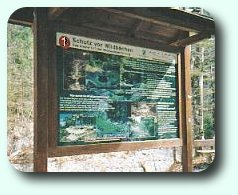
And already we stand in front of the first of ten really beautiful
information boards about the problems of the torrent with coloured
graphics and fotos. These boards will accompany us for the next
hour. This information could be a bit time-costly on our way to the
hut. On the other hand it would be a pity to ignore the very good
information.
May be a compromise could be good. Let`s now have only short looks
on the boards, notice that there is available a lot of data about
the maintenance of the torrent, about flora and animal world, and
let`s decide to have annother visite later with more time to be
informed.
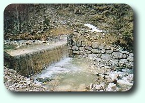
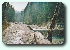
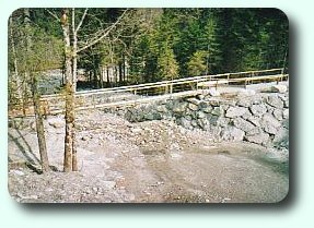
Attachments (left) graduate the course of the torrent which
decrease the dip of the water. The water falling vertically down
from some height keeps the big stones better on the spot. Some
small distance later it streams again with full power
downward.
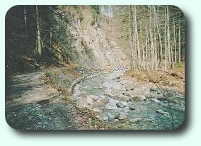
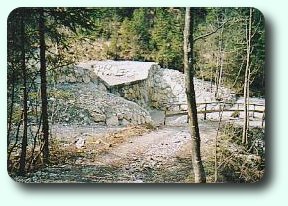
But have a look to the right! Notice at first the little hiker
between the big posts although rarely noticeable. His figure allows
you to better calculate the dimensions of the huge triftwood-fork
appearing after about 10 minutes walking time.
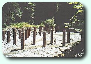
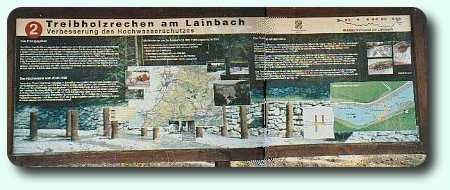
Here is an extra explicitely info-board about purpose and intention
of the triftwood-fork. It was first installed after the mentioned
disaster when huge amounts of triftwood had been bad consequences
in the village Benediktbeuern.
SHe who has studied the information knows the history and the
enormous tasks necessary to tame the torrent in the
Lainbach-valley.
A look back shows that the way follows the many windings of the
torrent one after the other. Walking into the valley direction hut
it is not very noticeable. But when returning after a long hiking
tour on the Benediktenwand it is wise to have a look at your watch
in order not to assume the end of the valley finally after the next
turn. Return lasts 50 minutes. The watch is much more
reliable.
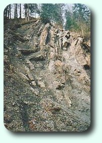
Interesting at the right hand are also the rocks laminations
towering vertically to the height.
Having crossed over a concrete bridge we continue walking on the
other side. Soon we cross again over a broad wooden bridge and
eventually reach the (private) Söldner Alm. 10 minutes later
our way leaves the Lainbach-valley where there is no further way in
the valley. Then we pass a tributary over a small pedestrian bridge
built by members of the section.
A look back (left side a big attachment) allows to notice that we
now have reached some height within a few meters. Now we have to
hike steep upward on a way with boulders and furrows. But it lasts
no more than 15 minutes and about 100 meters elevation. Then we
find a little resting place pausing for breath. Afterwards we walk
comfortable on broad forrest ways with only moderate elevation.
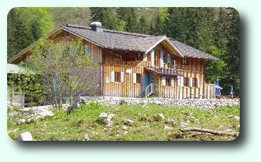
After 2 - 2 1/4 hours we reach the base station of the ropeway.
Following a small winding path upward we have a look back to the
base station of the ropeway. From here anything intented to reach
the hut (no persons!) has to be wound up by means of a rope basket
over about 220 meters elevation.
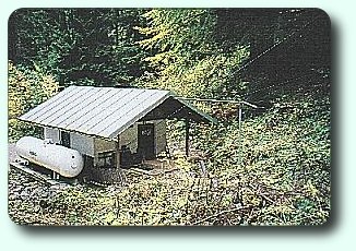
We hike about 30 minutes upward. Then we see the hut. There is
something to drink. Hooray!