
Families - Pessenbach to Benewand

In order to avoid the constraint to use the planned way also as
a return to our parked car, it is suggested to park the car at the
bridge over the lainbach (look way 456 for more info) or at the
Alpenwarmbad and then go to the center of Benediktbeuern and use
the bus to ride to Pessenbach parking-place. Then it is easily
possible to return from the hut via the very interesting
Torrent-Teaching-Path in the lainbach valley to meet the parked car
the fastest.
Off course it is much more better to come to the area with railway
and bus at all.
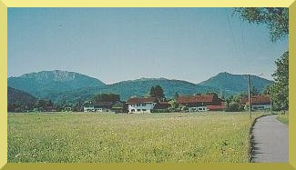
When one arrives to Benediktbeuern one can see the
Benediktenwand at the left, the Rabenkopf to the right and the
Glaswand in the middle. To the right saddle between Glaswand and
Rabenkopf we will hike upward at first. Then we will pass the
Glaswand at its southern side (to the left) and can hike up to the
summit of the Benediktenwand.
At first we will hike upward on a rough small way with boulders and
detritus, later on winding paths. Then we reach a high and flat
wooded area. Here in springtime when the mountains upward will be
snowy you can observe herds of chamois. At the end of that area we
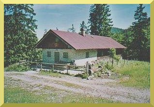
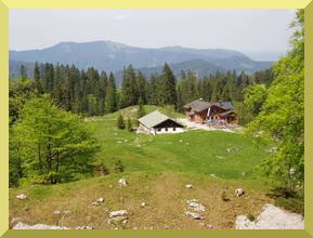
have reached the Orterer-Alpe, an former alp, now a private
weekendquarter. There not only a table and a bench but also a
bubbling wellspring are available and invite us for a break.
Then we hike over steap meadows upward passing a memorial for a
mountain-rescue-man met death with a avalanche. Before again hiking
through firs up to the saddle we throw a view back. At the left
down at the wood-triangle the Orterer-Alpe is to be seen and right
up some rock area of the Glaswand.
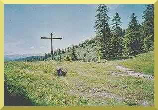
Eventually we have reached the saddle separating Glaswand and
Rabenkopf. There stands a memorial-stone and a memorial-cross. At
the right directly in front of the firs a small mountainpath first
passing a hut of the mountain-rescue-crew, then leading steaply up
to the Rabenkopf summit. When wet by rain or snow it is
uncomfortably dangerous by skidding on the loamy path. Then
circumspective hikers use the regular way to the summit directly
behind the firs and bypass almost even the southern slope of the
mountain and continues comfortably on a regular path to the
summit.
But we turn to the left, direction east, now on way 451 and hike
comfortably almost even along the southern slope of the Glaswand
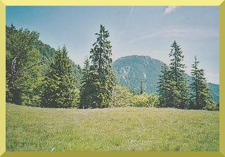
for the next half an hour. Before comming to the Glaswandscharte,
the gash between Benediktenwand and Glaswand, we have a view to the
western Wall of the Benediktenwand. At this wall we will hike a
good portion upward. After a few minutes we have to hike up on an
uncomfortable rough path with boulders and detritus to the
Glaswandscharte which on the picture is hidden by the big
fir.
Upstairs we turn to the right and hike up on steap winding paths
where we now and then have to use our hands to stabilize our
balance. After some more as half an hour the slope flattens and we
continue hiking over a meadow and pass some firs.
Then we meet the westway nr 455. We
now have to decide wether we want to hike to the right and directly
up to the summit or to the left down to the hut Tutzinger
Hütte. After now 3 1/2 - 4 hours bare hiking time we surely
prefere the fine drinks and bavarian beer at the hut.